Lockman Ridge Lookout
960X Knox Rd : Riverside, WA 98849
Okanogan County, Washington
Land Description
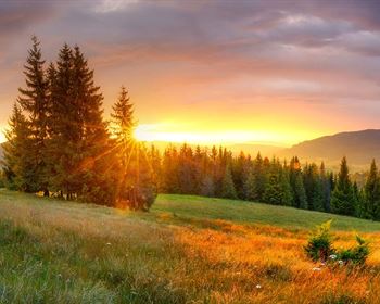
960 Acres are already subdivided into 20-acre parcels that border state land. Perfect property for hunting, hiking, or trail riding multiple roads throughout the property make it a fun place to explore. Many wildlife, including deer, Elk, and Moose, frequent the property. There are fantastic views across the valley and numerous places to build a home or cabin. And have access to thousands of acres of DNR land. Owner Financing Now Available Land
The 960 acres has already been subdivided into 20 acre parcels
Recreation
Okanogan County in North-Central Washington State has the best family vacations. Scenic byways, tours, hikes, and family adventures await you in every corner of Okanogan Country from the Northern Okanogan Region, to the Methow Valley, across the Columbia River Basin, and into the Heart of the Okanogan. An affordable family vacation with endless outdoor adventure awaits you in our breath taking snow-capped North Cascade Mountains and gorgeous winding river basins. Experience a Washington State getaway with horse riding, miniature golf, swimming, fresh wholesome food, blue skies, and starry nights - a vacation that will keep you coming back for more.
Region & Climate
Okanogan, Washington gets 13 inches of rain, on average, per year. The US average is 38 inches of rain per year.
Okanogan averages 33 inches of snow per year. The US average is 28 inches of snow per year.
On average, there are 192 sunny days per year in Okanogan. The US average is 205 sunny days.
Okanogan gets some kind of precipitation, on average, 67 days per year. Precipitation is rain, snow, sleet, or hail that falls to the ground. In order for precipitation to be counted you have to get at least.01 inches on the ground to measure.
History
Uriah Ward is given credit for settling Riverside in the 1880S. It was and still is located at the mouth of Johnson Creek, south of Janis Bridge and about 7 miles north of Omak on the Okanogan River. Riverside's name came from its location next to the Okanogan River. Riverside is outside Obhs area but was very important to the north area. When steamboat travel started on the river Riverside became the head of navigation and a mayor distribution center especially during high water.
Riverside was originally known as Republic Landing, was platted by James E. Forde in 1902 and officially incorporated December 22, 1913.
Location
Located within minutes of the town of Riverside with a small store or Omak is just 20 minutes away with all primary services Walmart, Home Deport, or Mid Valley Hospital.
Spokane International airport is 110 miles away
Bellingham International airport is 139 miles away
Seattle International airport is 149 miles away
Directions to Land
From Riverside go to store, left over bridge and left on Tunk Creek Rd. Follow to Knox Rd stay right at the "Y" follow to the end.
More Land Details
More Land from Hayden Outdoors
 New461.6 AC : AUCTION
 486 AC : AUCTION
 114.7 AC : $2.5M
 251.5 AC : $950K
 472.7 AC : $895K
  80 AC : $1.6M
 0.2 AC : $1.15M
 950.8 AC : $5.5M
 263.5 AC : $2.59M
 4.8 AC : $695K
 3,252 AC : $4M
 505 AC : $4.39M


