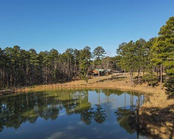
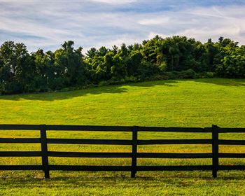
Perfect Spot for Your Dream Ranch
Juarez Rd : Fort Garland, CO 81133
Costilla County, Colorado
Land Description
Owner Financing Available ($999 down + $99 doc fee):
- 12 months same as cash.
- $443/Mo for 72 months
- $760/Mo for 36 months
Build your dream cabin on this 10 acre beauty. This listing is for two contiguous properties APN 70211820 & APN 70211830. These can be sold and deeded separately if desired.
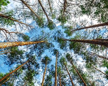
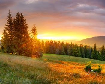
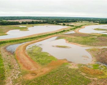
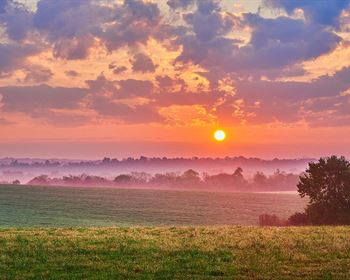
Want a property with amazing views of Mount Blanca and Mount Lindsey and excellent 360 views? This might be the perfect match for you. This property also has excellent access to Highway 160 that goes to Fort Garland and Alamosa or east to Walsenburg. All photos are of the actual property and just taken in Sept 2023.
This great spot in the foothills of Sangre de Cristo mountain range is perfect for recreational activities like Trinchera Blanca Ranch, ATVs, hiking and world class trout fishing in the nearby Mountain Home Reservoir. Come to your little slice of paradise for a weekend of camping under the star-filled sky. Or build your dream home and stay for a lifetime, with the powerful presence of 14,000-Foot peaks standing watch over you on all sides. You're off grid in nature but only a few miles from everything you need in the historic town of Fort Garland. The mountains and the great outdoors are calling your name. Are you finally ready to answer? Give me a call today.
Please check out the drone video and photos we just took showcase the amazing 360 degree views of this property.
Sangre de Cristo Ranches (Sdcr)
If you're looking for the great outdoors, clean air, and wide-open spaces, the Sangre de Cristo Ranches are about as good as it gets. In the foothills of the Sangre de Cristo Mountains, you will be surrounded by priceless views of the Rocky Mountains, with Mt. Blanca (14.3K feet) and Trinchera Peak (13.6K feet) hovering above you.
Your days will be as full as you want them to be. Spend hours hiking, hunting, fishing, and watching nature during the day. While relaxing after a hearty dinner, enjoy the sunset that is often a beautiful red color on the Sangre de Cristo Mountains, which inspired their name, which means Blood of Christ. After the sun is down, you'll likely be content just gazing at the incredible night sky as you are re-introduced to just how many stars there are - and how bright they can be without city light pollution.
The lots in Sangre de Cristo range in elevation from 7,900 to 12,000 feet, with a variety of terrains from rolling to hilly to mountainous. Vegetation at the lower elevations consists mostly of sagebrush and Piñon, with taller varieties of pine being prevalent above 9,000 feet. The community contains some full-time residents combined with a lot of empty land whose owners use it for occasional camping and recreation. There is no problem with overcrowding around here. The roads are maintained by Costilla County and are accessible by cars and trucks in all but the most extreme weather conditions.
Wildlife is abundant in this area, whether for viewing or for hunting. There is a Greenbelt with over 5,000 acres set aside to the public for hunting and other forms of recreation. Elk are common, with roughly 7,000 head in the local herd, and highly sought after by avid hunters. You'll also see plenty of deer, antelope, and other animals roaming the region. This is outdoor recreation at its finest. There is even a new ski area opening up an hour away, Cuchara Valley Resort.
The region begins just 6 miles southeast of the historic town of Fort Garland, “the gateway to the San Luis Valley.” At the intersection of US Highway 160 and Colorado Highway 159, Fort Garland is home to services like a post office, gas stations, a grocery store, and several restaurants. A half hour west from there is the larger hub of Alamosa, which offers a university, hospital, restaurants, grocery stores, Home Depot, Walmart Supercenter, and an airport. As natural and rustic as the Ranches may be, you won't be too far away from modern necessities and conveniences.
Local Attractions
Mountain Home Reservoir - 7 min (2.6 miles)
Smith Reservoir - 25 mins (12 miles)
Trinchera Ranch - 6 min (2.0 miles)
Blanca Peak - 30 min (16 miles)
Great Sand Dunes National Park - 39 min (33.9 miles)
Closest Towns
Fort Garland, Colorado 81133 - 13 mins (7 miles)
Blanca, Colorado 81133 - 18 mins (12.2 miles)
San Luis, Colorado 81152 - 20 mins (18 miles)
Alamosa, Colorado 81101 - 36 mins (31 miles)
La Veta, Colorado 81055 - 41 mins (37 miles)
Additional Property Details:
Power: Extend existing power lines to the property. Common alternatives are solar, wind, or generator.
Water: Would be a well, or water haul + holding tank (or other similar option.)
Sewer: Would be by septic system.
Zoning: Vacant Land/Residential - Site built home 600sqft min, manufactured homes are acceptable. Camp for 14 days (every 3 months); long term camping/rv permit available (60 days - with up to 3 renewals, $200 fee - septic & water required); Temporary RV Occupancy permit available ($250 fee - good for 90 days at a time while building, renew for up to 18 months). Please contact Costilla County Planning & Zoning for additional information.
Joining the Sangre de Cristo Ranch Owners Association is “optional” for residents and landowners. When joining the community, dues are required in the form of a small fee every year. Benefits of membership include:
Voting privileges
Access to the Semi-Annual Newsletter
Admission to community-sponsored events
Eligibility to assist or become a Board Executive member.
Updates on changes in the community
Annual dinners
Participation in Dumpster Days
As a member you will support your land, and community, by providing protection, beautification, and assistance with programs such as Meals on Wheels, Crime Stoppers, County Initiatives, and many other future activities. To become a member of the Scro, you are required to complete and submit the form found on the land website link below. You can also join the Scro official Facebook group.
Property Boundaries (Lat/Long Coordinates)
37.3635, -105.5551
37.3636, -105.5521
37.3618, -105.5523
37.3618, -105.5551
Nearby Recreation:
Costilla County is ideally located for recreation seekers. Hunting, fishing, skiing, hiking, boating, history. You name it, it's close by in the great outdoors. And never far from stunning, snow-capped mountain peaks.
If you're a skier, the nearby Taos Ski Valley across the border in New Mexico has outstanding ski slopes, as well as white water rafting and historic tours. Great Sand Dunes National Park lies just to the north of the county, offering exhilarating sandboarding and sand sledding (that's snowboarding and sledding on sand - if you haven't tried it, you must) on the tallest dunes in North America. The park is also a Dark Sky Park, with very little external light pollution, offering some of the best stargazing in Colorado. You'll find peace and beauty that make you feel like a part of outer space - which is worth a lot in today's busy and crowded world.
When it comes to trails and hiking, you could hike a different trail every day of the year and never run out of new options. The county is home to many reservoirs, including the Sanchez and Smith, providing top quality fishing, swimming, boating, and paddle boarding. And we certainly can't forget the famed Rio Grande River, offering not only great fishing, but also canoeing, kayaking, and tubing.
With endless Native American, Mexican, and colonial American history, there is also a lot to see and learn in the San Luis Valley of Costilla County. The historic small town of San Luis is the oldest town in Colorado, and it contains a famous Stations of the Cross in bronze statues, drawing in visitors from far and wide. The town of Fort Garland is home to the fort of the same name, which was the last command of the legendary frontiersman Kit Carson. The list goes on. There's something for everyone in Costilla County - especially those who love the outdoors.
Land Maps & Attachments
Directions to Land
This property is on Juarez Rd, a very good condition county-maintained dirt road. Nearest Cross Street is Bateman Rd and Juarez Rd. The best way to find the property is to put the coordinates 37.3553, -105.371 into google maps or your GPS to get directions. Please contact me if you have any questions or require additional directions.


