10 Acre Arizona Gold Mining Claim
Prescott, AZ 86301
Yavapai County, Arizona
Land Description
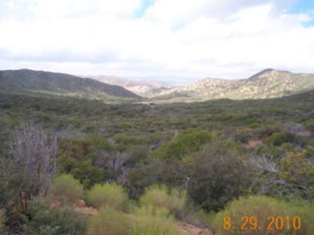
This is a 10 acre unpatented, gold mining claim, part of the Pay Dirt #1 placer claim. The main claim is legally registered with the Bureau of Land Management out of Phoenix. The total price is You own the mineral rights, not sharing with others, on the 10 acres, and use your 10 acres, recreationally for camping: tent, camper, or RV, and prospecting. Beautiful views of nearby mountain ranges.
By filing a BLM assessment form, a building can be built on the land: any building that benefits and improves the claim, though you cannot permanently live on the claim.
**I returned from the claim, and spending just a weekend, we found about 1/8 of an ounce of gold, value approx. Those with more time to prospect will find more.**
_______________________________
10 acres = 435,600 sq., feet., parcel size of 330 ft. x 1320 ft.
_______________________________
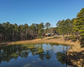
This claim has great access, several nice areas for camping, and gold discovered in surface prospecting. National Forest Service Rd. 362 goes right thru the claim, for easy access. There is seldom anyone on the road, as is a rather secluded and private area.
We also have a home in the Phoenix area. Come join us in Arizona, a most unique and wonderful experience.
Yavapai County was originally settled by gold miners, and this area has a history of the most gold discoveries in Arizona. The current Forestry Roads, one which crosses thru the claim, are the original mining claim roads from those early prospecting days. Gold prospectors only established roads, if significant gold discoveries were made.
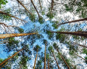
The Ponderosa pine covered Bradshaw Mountains, are considered the richest of all mineral-laden ranges in Arizona, and is where Pay Dirt #1 is located. In central Arizona, Yavapai County ranks first among the gold producing counties, having produced over 3,500,000 ounces of lode gold and over 300,000 ounces of placer gold. The Bradshaw Mountains give rise to a number of important gold districts all along its length. The gold districts located in the Bradshaw range are among the most productive placer fields in the state, and still yield gold to individual prospectors working there.
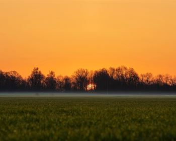
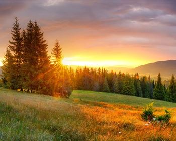
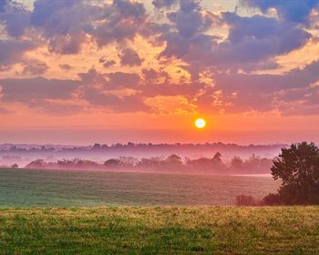
Yavapai County is located in the central region of Arizona. It is a land of deep character and changing terrain. Prickly Pear dot the slopes of the desert lowlands and willowy aspen shimmer in the cool mountain air. Views are far-reaching capped by clear blue skies. Prehistoric remains of the Sinaguan people are tucked into sandstone ledges and prominent hilltops. You’ll find ghost towns and remnants of a mining heyday hidden in rocky canyons and forested mountainsides. Area lakes are nestled in the pines surrounded by thousands of miles of hiking, biking, and horseback riding trails. Prescott was Arizona’s first territorial capital. The real spirit of the West is fully alive in this timeless territory.
_____________________________
A transfer of ownership is a sale of legal, exclusive ownership in a mining claim site. To be a legally recorded claim, gold had to be found on the claim, which was completed by the prospector owning before us, and by my own prospecting.
_____________________________
Your ownership is legally conveyed via a Quit Claim deed, and legally recorded with the BLM and the county. A Quit Claim deed is the required legal document per the BLM. Each year, on or before September 1st, you need to file a form with the Bureau of Land Management, along with We will supply this form to you. We have paid the fee, so not due again until Sept. 1, 2011. There are no taxes, as Arizona does not tax mining claims
____________________________
An unpatented mining claim is a specific parcel of federal land, valuable for a specific mineral deposit or deposits. It is a parcel for which an individual has asserted a legal right of possession and the right to develop and extract a discovered, valuable, mineral deposit.
Mining claims are real property that you can buy, sell, or inherit. After proving the existence of valuable minerals on the land, the claim is legally recorded with the Bureau of Land Management, and the local county.
______________________________
Your 10 acres is the W 1/2 of the E 1/2 of the SW 1/4 of the Pay Dirt #1 claim, which is located in Township 10N, Range 2W, Section 36, Quarter Section SW, G&SR Meridian, Yavapai County, Arizona. Claim # AMC372851.
Directions from Phoenix, about 80 miles north.
Take I 17 north, exit 223B for AZ 74 W/Carefree Hwy., turn right
Turn right at N. Castle Hot Springs Rd., continue on
Turn left to stay on N. Castle Hot Springs Rd.
Turn right to stay on N. Castle Hot Springs Rd., continue on
Turn left to stay on same road….then right at Buckhorn Rd.
Turn right, then another right on Buckhorn
Turn right toward Forest Rd. 362, and turn right on FR 362
Continue onto FR 362 to ghost town of Minnehaha
Pay Dirt #1 Mining Claim is 1 mile west of Minnehaha, GPS coordinates listed to pinpoint.
Directions from Prescott, about 30 miles south.
Take South Senator Highway, south out of Prescott
Slight left to stay on SHwy
Turn left to stay on SHwy
Turn right to stay on SHwy
Turn right to stay on SHwy
Take the 1st left to stay on SHwy
Take sharp left at Forest Rd. 52
Then turn right at FR 52/S. Senator Hwy.
Slight right at FR 52
Continue onto Forest Rd. 362 to ghost town of Minnehaha
Pay Dirt #1 Mining Claim is 1 mile west of Minnehaha, GPS coordinates listed to pinpoint.
_________________________
Gold always occurs in gravels in the metallic state and when so found has various physical characteristics. Gold is dense and heavy, it has a characteristic metallic color, and it is soft and easily malleable (it is easily formed by hammering). These are the characteristics used by prospectors to identify gold in the field.
Placer gold occurs on the claim as small grains derived from gossan formed by weathering, and oxidation of the gold, copper and iron rich veins. Gold also occurs as grains flakes and small nuggets derived from the erosion of mineralized fault zones on, and upstream from the claim.
____________________________
A dried up creek also runs thru the claim, being a large extended wash, which is a great place to prospect for gold.
_____________________________ is for your ownership of the 10 acre claim.
The Federal Government owns the land.
You are purchasing the mineral rights.
By filing a BLM assessment form, a building can be built on the land: any building that benefits and improves the claim.
You can legally camp, with camper and RV use of the whole 10 acres. Prospect, explore, and camp on the whole 10 acres.
_____________________________
TERMS: is the total price. Seller accepted payment methods: only cashiers check, and/or credit card using our merchant account. ________________________________________
GPS Coordinates:
Pay Dirt #1
34.164936 -112.431656 n/w
34.157726 -112.431656 s/w
34.164957 -112.422944 n/e
34.157726 -112.422944 s/e
Area Information Links:
City of Prescott Tourism Information National Forest Crown Mountains - Gold Fever