Manning Farm
Leesburg, GA 31763
Lee County, Georgia
Land Description
The Manning Farm is ideally located around the agricultural production and plantation properties of east Lee County. This farm provides the opportunity to expand your current farming operations, establish a rural residential estate, or as a fantastic hunting property. Stately live oaks border the agricultural fields, providing scenic views and wildlife cover. The extensive frontage on New York Road offers subdivision opportunities as well. This property sale consists of two ownerships that will be sold together in simultaneous closing. Owners information is described in the tax portion of this report.
Location
Manning Farm is located in a heavily agriculture-dominated region. The landscape is comprised of mixed agriculture, timber, and recreation uses. Property uses to the north, south, and west include agricultural production and hunting properties, while uses to the east include rural residential ownership. The Flint River is less than 3 miles to the east of the property.
The closest population center to the property is Leesburg, Georgia, a bedroom community in the Albany metropolitan area. Phoebe Putney Memorial Hospital in Albany is the region's main healthcare facility. Local attractions include Chehaw Park, Radium Springs, Lake Blackshear, and Andersonville National Cemetery.
US Hwy 19 is a major north/south corridor that connects the Atlanta area with South Georgia and North Florida. GA Hwy 300 is a connector to I-75 for southwest Georgia. US Hwy 82 is an east/west connector that runs from the Georgia coast to Alabama west. Numerous local county and state roads connect with these major corridors to transport agricultural goods and timber products across the region while serving as main travel ways for commuters. Population centers in the region include Leesburg (population 3,480), located 9 miles southwest; Albany (population 67,192), located 18 miles to the south; Cordele (population 9,914), located 28 miles to the northeast, Americus (population 15,642), located 28 miles to the north, and Dawson (population 4,414) located 28 miles to the west. Southwest Georgia Regional Airport is located in Albany, 22 miles south.
Access
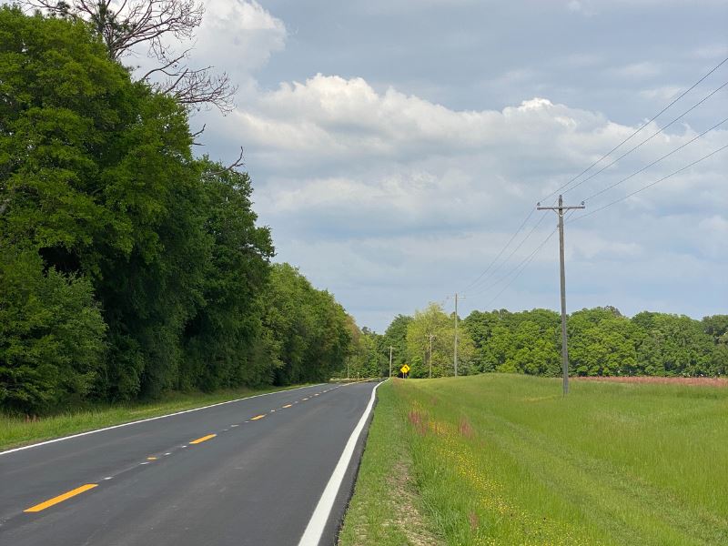
The property is bisected by New York Road east to west and Laramore Road along the eastern boundary in east Lee County. New York is a paved county road that has recently been resurfaced. Laramore Road is a county-maintained graded road. There is one driveway cut to access the northern portion of the property and one access point near the intersection of New York Road and Philema Road for the southern portion of the property. The property has 0.6 miles of frontage on New York Road and 0.2 miles on Laramore Road. Power is located along the 0.6 miles of frontage of New York Road. Internal access is provided by field roads that traverse the field edges of the property.
Site Description
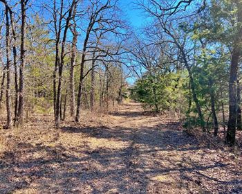
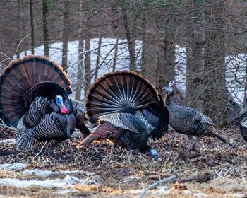
Manning Farm consists of 173.5 acres of dry land cultivated fields, 18 acres of natural upland timberland, 29 acres of natural lowland timberland, and 14.5 acres of natural upland timberland. Soils consist of Tifton sandy loam (47.2%), Tifton loamy sand (25.5%), Irvington loamy sand (18.7%), Grady soils (5.5%), Goldberg loamy sand (2.0%), Sunsweet sandy loam (1.0%), and Norfolk loamy sand (0.1%). Except for the Grady soils, all other soils are well-drained for all agriculture and timber production. Stately live oaks adorn the natural woodland areas and field edges. A 1-inch well is located in the northern portion of the property but is not currently connected to power. Abundant wildlife traverses the property, including deer, turkey, and quail.
Timber
The property consists of naturally regenerated timber in 2020, with natural hardwood and pine thickets interspersed across the property, providing excellent wildlife habitat.
Land Maps & Attachments
Directions to Land
From the intersection of GA Hwy 32 and US Hwy 19 in Leesburg, go west 180 feet to the intersection with GA Hwy 195, take left at the stop sign onto Hwy195, and travel 4 miles to the intersection with New York Road. Turn Right on New York Road and travel 4.6 miles to the western property boundary. The property is on the north and south sides of New York Road.
