Ofelia Tract
Wedowee, AL 36278
Randolph County, Alabama
Shown by Appointment Only
Land Description
The Ofelia Tract is located within the piedmont region of east-central Alabama and is on the edge of the southernmost reach of Appalachia. This area features a rolling landscape of hills and valleys.
The tract is bordered by privately owned timberlands to the north and south, and the east side is bordered by land owned by Alabama Power Company, which borders Lake Wedowee. As the “crow flies,” Lake Wedowee is less than a quarter mile from the property's eastern boundary. A boating access is located only 4 miles away on AL Hwy 48.
Lineville, Alabama, is approximately 10 miles to the west, and the Town of Wedowee, Alabama, is about 10 minutes to the east. Both towns provide grocery, gas, and quick dining options. Wedowee has a medical facility.
Ofelia is just a few minutes off AL Hwy 48, and US 431 is merely 10 minutes away. The City of Roanoke, Alabama, is located approximately 25 minutes to the southeast. Roanoke provides dining, provisions, and lodging. The Atlanta International Airport is about two hours away.
Access
A deeded easement off County Road 57, a paved county road, provides access to the property. A single private gate opens to a woods road currently suitable for off-road vehicles. The tract has direct access to power. The interior road was constructed in conjunction with logging several years ago.
At the last timber cutting, outside property boundaries were marked with blue and orange paint. There are also old fences that run many of the outside boundaries. There is red paint running along the eastern boundaries that are shared with Alabama Power Company.
Site Description
The tract's terrain is rolling, with elevations running from approximately 795 feet to 950 feet above sea level. The soils are rated well for timber production. A system of creeks runs through the property.
The primary creek runs from west to east and holds water almost continuously. The tract's proximity to Lake Wedowee suggests potential for development.
This area of the state provides quality deer hunting opportunities, and there is plenty of evidence that they are using this tract. A food plot has been established on the east side. Lake Wedowee has phenomenal bass and crappy fishing. The lake is just minutes away. The Tallapoosa River is accessible just below the lake, offering fantastic kayaking and canoeing. Talladega National Forest is within a 30-minute drive.
Timber
A timber harvest was conducted in 2018. In 2020, 51 acres of the tract were planted with genetically improved loblolly pine. These plantations are developing well and offer timber management options and income for the future.
Following “normal” timber management, these plantations should be thinned at or near age 15 and again at age 21. These thinnings will keep the plantation growing and developing well. While the thinning will be an income-producing event, its main purpose is to keep the plantation healthy. Once thinned, wildlife and aesthetic-enhancing actions, such as prescribed burning, can be employed. Within this market region, loblolly plantations reach financial maturity between the ages of 26 to 30.
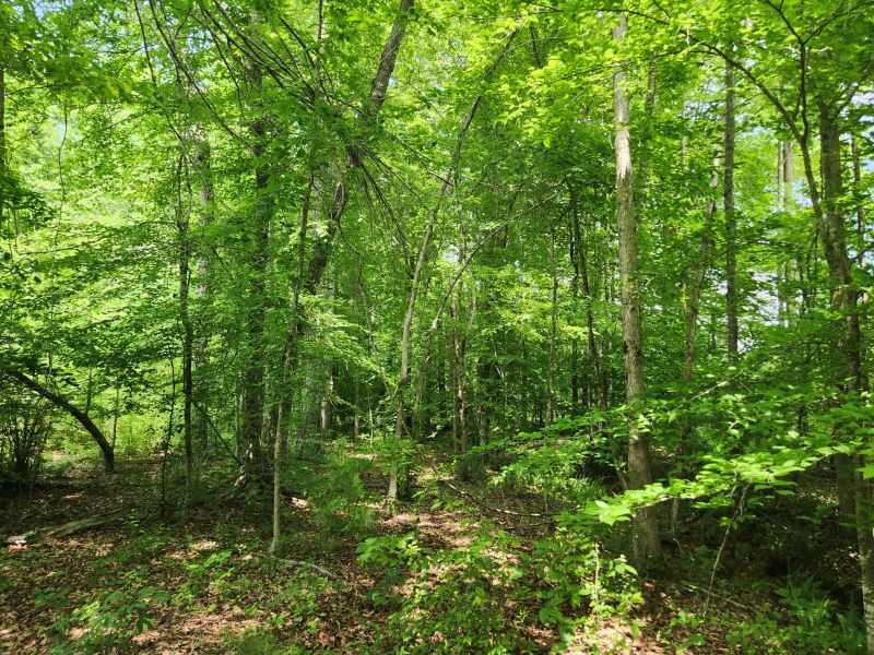
Approximately 11 acres of mixed hardwood and pine natural timber follow the run of the creeks on the tract. Most of this acreage is within the Streamside Management Zone (Smz), which functions as a protective agent of the stream, keeping out sediment and regulating water temperature. They also function as wildlife travel corridors and add diversity to the property. There is a strong representation of oak species providing mark mast browse in the fall of the year.
Most landowners choose to leave these stands intact. Leaving them intact protects streams' integrity, creates wildlife travel corridors, and adds diversity to the property. State BMPs for forestry do allow some harvest with the Smz.
