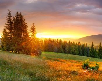
Power, Road Access, Mountain Views
Rocky Gap Road : Alcova, WY 82620
Carbon County, Wyoming
Land Description
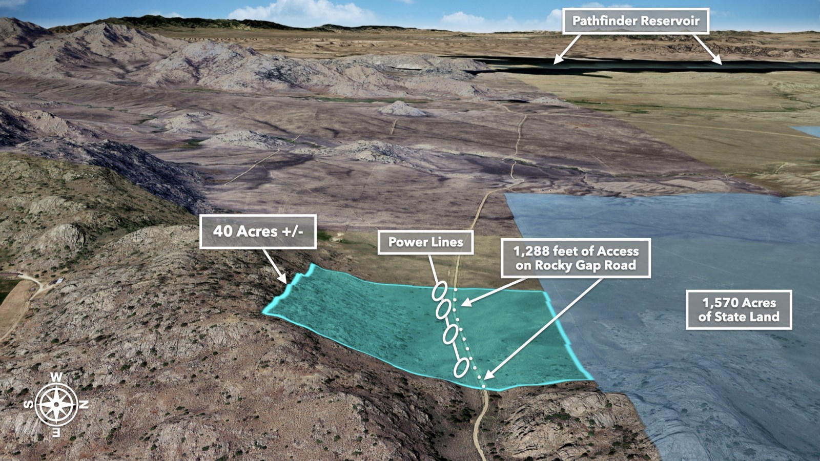
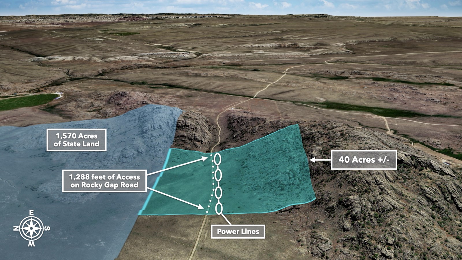
40 Acres with Road Frontage, Power, Rock Formations, Open Pastures & Mountain and Water Views
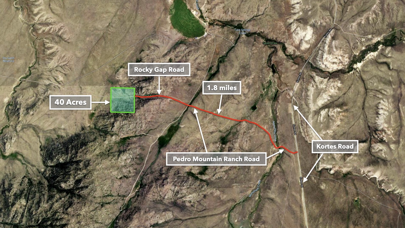
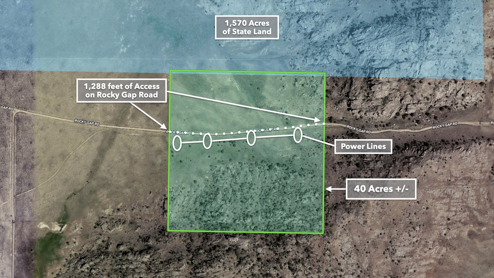
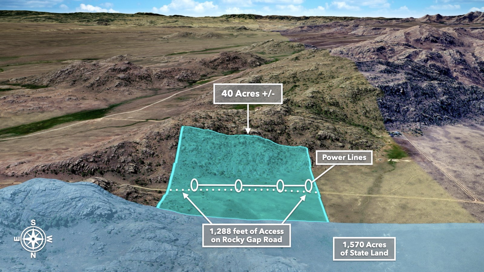
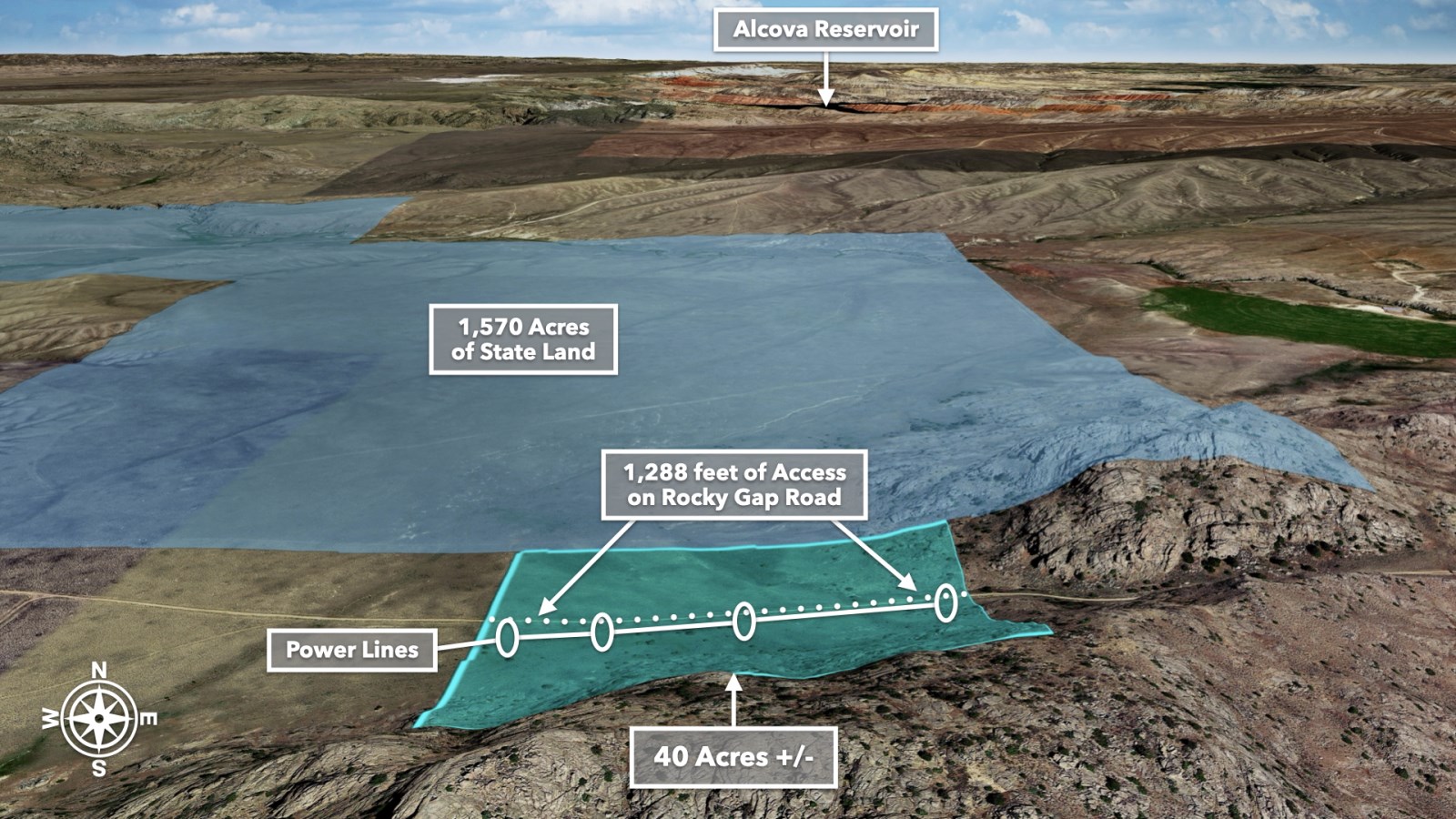
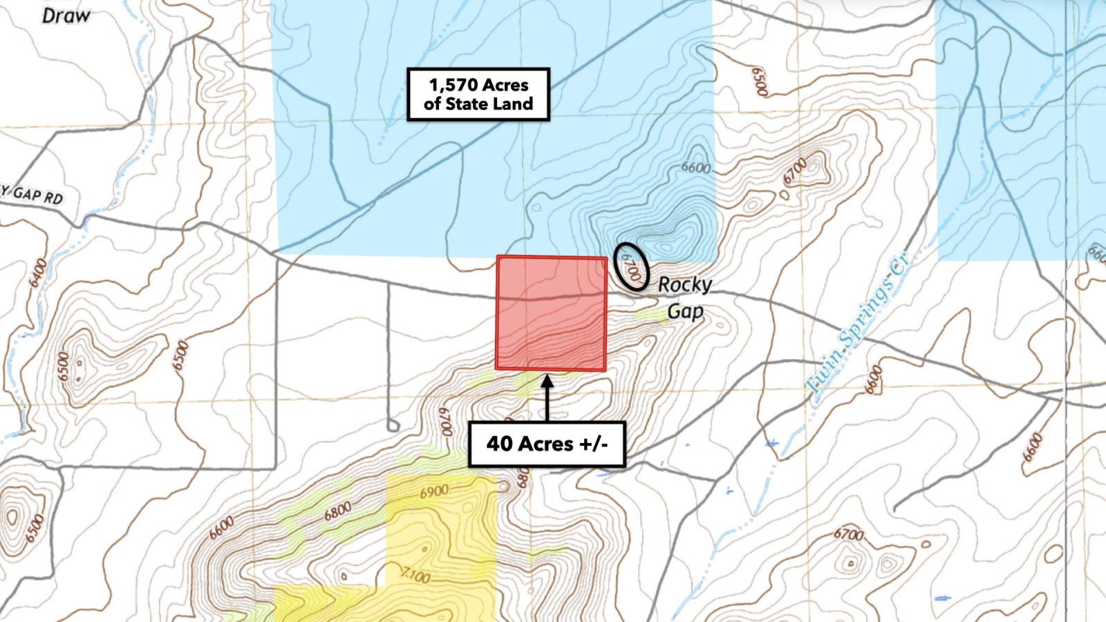
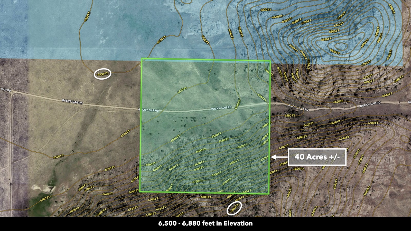
This expansive 40 Acre parcel offers prime access with 1,288 feet of road access along Rocky Gap Road. Electricity is already available with power lines in place. The property borders 1,570 acres of State Land to the north and is situated within close proximity to over 1 million acres of public land, including the scenic Pyramid Peak and Heaths Peak.
Prime Location for Outdoor Enthusiasts
Located in Southern Wyoming's Carbon County, the area is rich in wildlife and outdoor recreation opportunities. The property is within designated hunting zones for Antelope, Elk, Bighorn Sheep, Deer, Mountain Lion, Pheasant, Sage Grouse, and Wild Turkey.
Casper Mountain is just over 1 hour away and offers a variety of outdoor activities, including scenic hiking trails in the summer and exhilarating skiing and snowboarding in the winter.
World-Class Fishing and Water Recreation Nearby
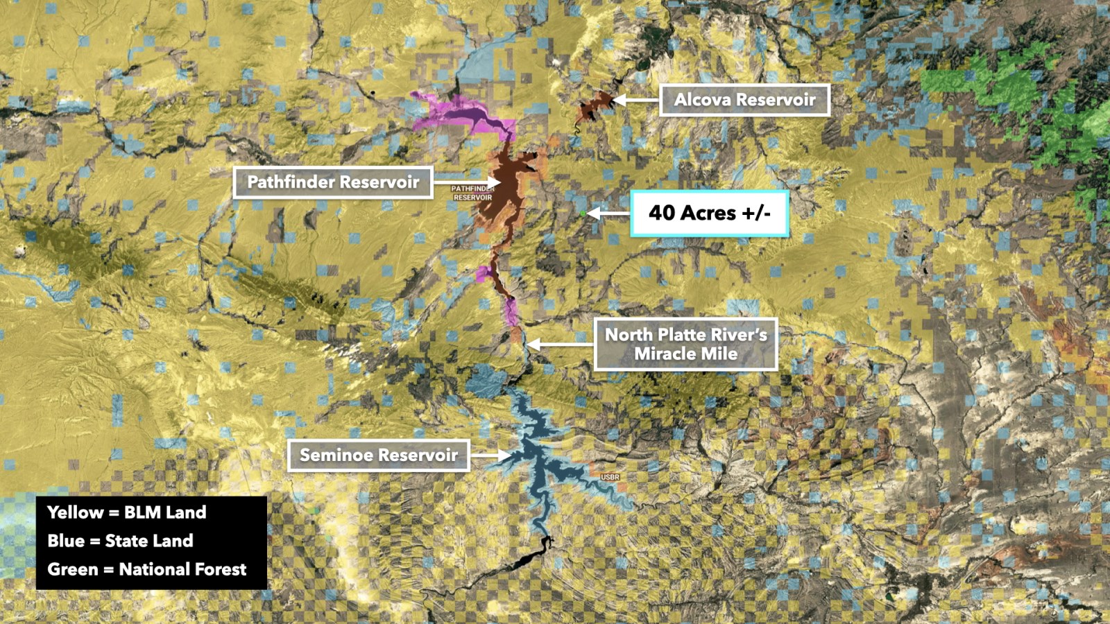
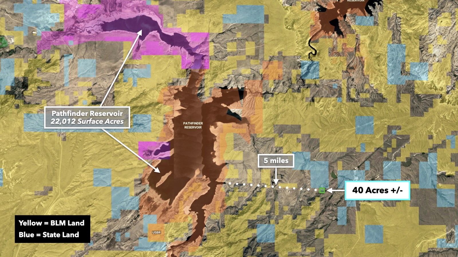
The property is just a 7 mile drive from the renowned Pathfinder Reservoir, a 22,012 Acre lake known for its colossal walleye, trout, and carp. Pathfinder hosts numerous professional walleye tournaments during the summer and one of Wyoming's largest ice fishing events, the Hawg Ice Fishing Derby, in the winter.
The Alcova Reservoir, a short 32 minute drive away, offers diverse water activities such as water skiing, sailboating, and fishing for walleye and trout. Additionally, Seminoe State Park, located about 34 miles northeast of Rawlins, is home to vast white sand dunes, acres of sagebrush, and abundant wildlife. The Seminoe Reservoir within the park is known for its trout and walleye fishing and boasts 180 miles of shoreline, making it one of Wyoming's largest man-made reservoirs.
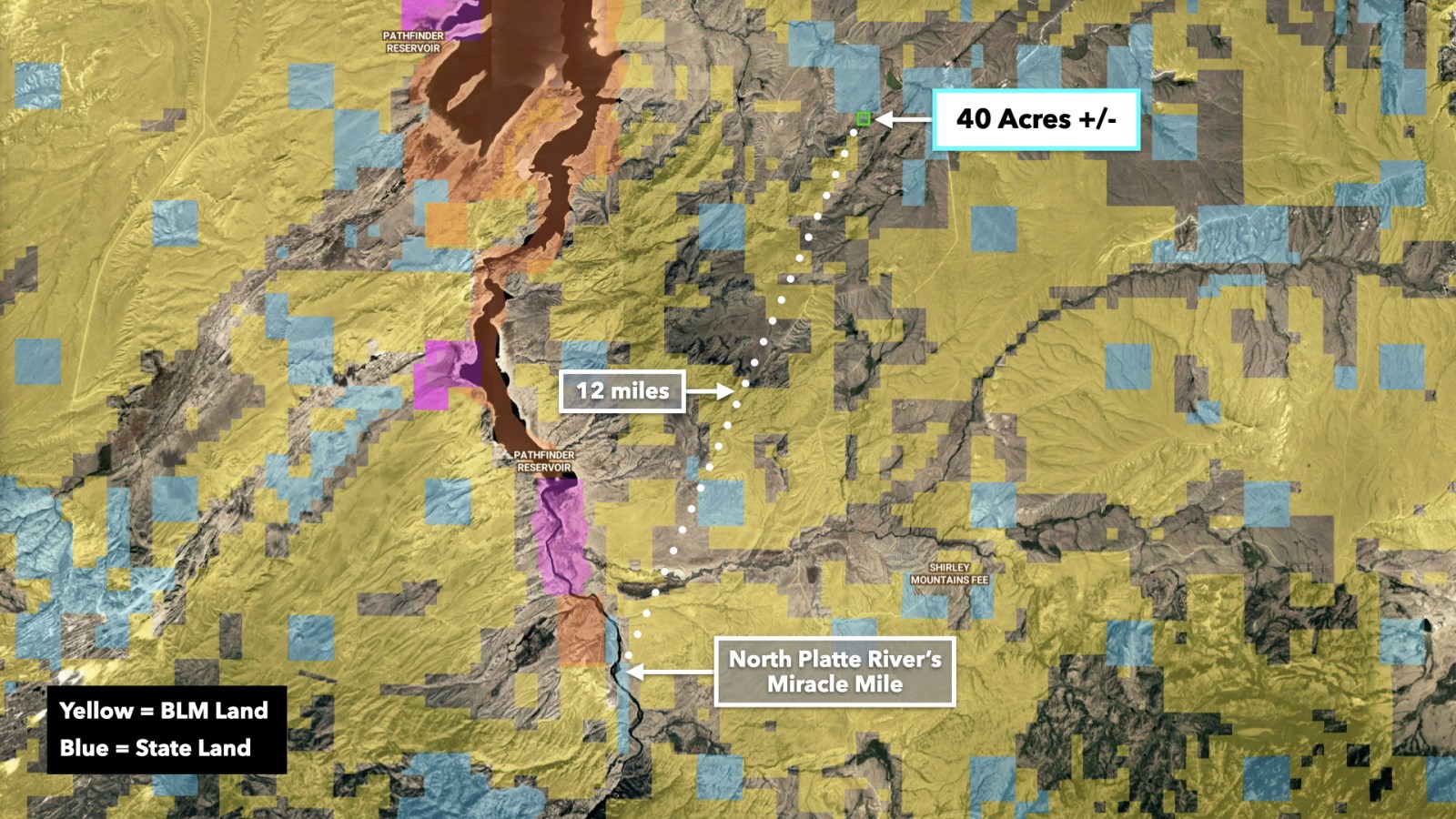
Fishing at the Miracle Mile
For avid anglers, the Miracle Mile - a 5.5 mile stretch of the North Platte River fed by Seminoe Reservoir - offers some of the best fishing in the region. With approximately 4,000 fish per mile, this fertile tailwater provides ample opportunities to catch trophy trout. The area is best explored on foot, though it is also boatable.
Access and Infrastructure
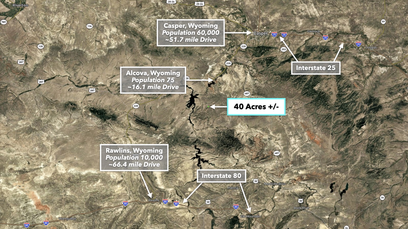
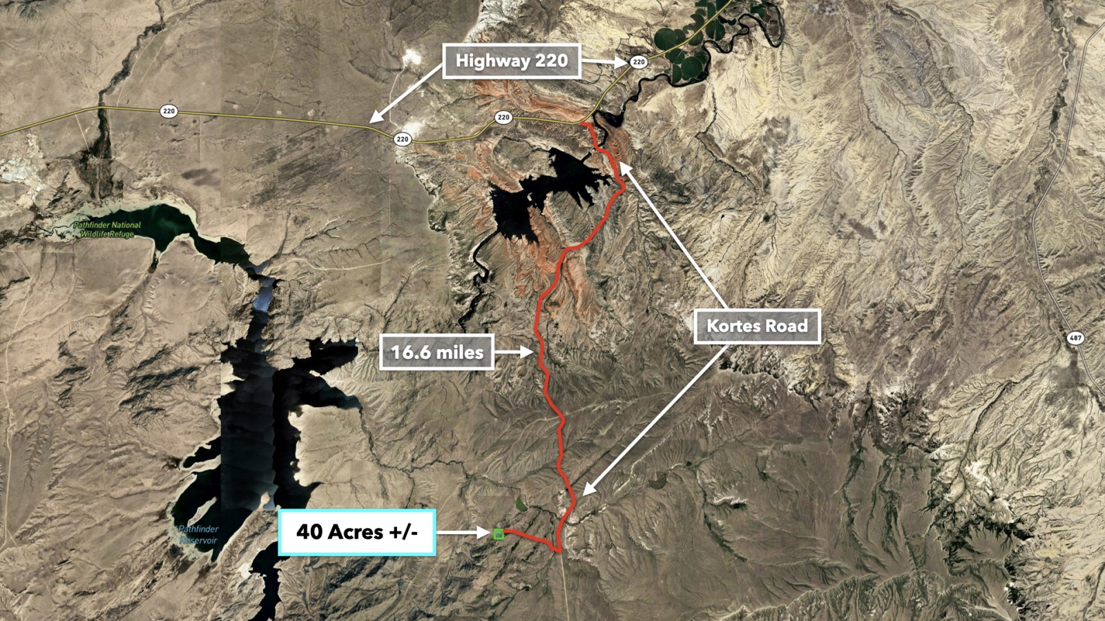
The property is easily accessed via Kortes Road, located just 1.8 miles to the east. From Kortes Road, you'll have direct access to Highway 220, leading to Alcova and Casper to the northeast. Casper is a vibrant, welcoming city nestled along the North Platte River, offering a perfect balance of urban amenities and outdoor adventure. Known for its rich history, excellent schools, and strong sense of community, Casper is an ideal location with easy access to hiking, fishing, hunting, and skiing in the nearby mountains. There is an International Airport in Casper. The code for this airport is Cpr. For more information, please visit their website at landowners include cabins, homes, and ranches, with some residents living here year-round and others seasonally. The property allows for up to 4 residential structures, including alternative housing options such as tiny homes, shipping container homes, barndominiums, earthships, straw bale houses, geodesic domes, mobile homes, and manufactured homes.
Light Covenants to Preserve the Area's Beauty
The property is subject to light covenants designed to protect the natural beauty of the surrounding landscape, ensuring it remains a peaceful and scenic retreat.
Excerpts from the covenants read:
All lands described shall be used. solely for the construction and occupancy of single family dwellings, and no more than four residential units shall be constructed, erected and maintained on each forty (40) acres. Each residence may be accompanied by no more than two outbuildings used for the maintenance, storage and housing of vehicles, equipment and animals.
Trailers, mobile or modular homes and like residential structures must be built and maintained upon a permanent concrete, brick or cinder block foundation with approved roof. Temporary buildings may be constructed and occupied on the premises for not more than 180 consecutive days during the period of construction of acceptable permanent residence.
Trailers, mobile or modular homes, in addition to requirements for acceptability as herein stated, shall be skirted and tied down in a workmanlike and satisfactory manner. One camper mobile home or like recreational vehicle may accompany each permanent residence so long as the same is not parked on any public road and said vehicle is not upon the premises more than thirty (30) consecutive days.
Download the Covenants & Easements on Landio
The Wyoming State Engineer's Office has a water well permit search tool that shows water wells drilled on nearby properties where the water depth ranged from 8 feet to 45 feet.
Property Specifications
Parcel Size: 40 Acres M/L
Landio Property ID: Wy_Carbon_00038
General Elevation: 6,500 - 6,880 feet
Legal Description: Nw1/4Ne1/4: Sec 21 T 28 R 83
Apn: R0014760
Property Taxes: $230 per year
Title: Free & Clear
Conveyance: Warranty Deed
Nearby Points of Interest
6.9 miles to the Pathfinder Reservoir
16.1 miles to Alcova, WY : Population 75
17.9 miles to North Platte River's Miracle Mile
21.6 miles to Alcova Reservoir
48.6 miles to Seminoe Resevoir
48.7 miles to Casper Mountain
51.7 miles to Casper, WY : Population 82,000
66.4 miles to Rawlins, WY : Population 10,000
84.5 miles to Bow River Campground : Medicine Bow National Forest
126 miles to Laramie, WY : Population 33,000
174 miles to Cheyenne, WY : Population 65,000
287 miles to Denver, CO : Population 3,000,000
Visiting the Property
To Schedule a Tour of the Property, Please Contact the Listing Agent Rebecca Williams by Call or Text anytime at:
Gps Coordinates (approximate)
Northwest Corner: 42.389056, -106.774889
Northeast Corner: 42.38899, -106.770148
Southeast Corner: 42.385362, -106.770208
Southwest Corner: 42.385424, -106.774911
Center Point: 42.387130, -106.772502
Land Maps & Attachments
Directions to Land
To Schedule a Tour of the Property, Please Contact the Listing Agent Rebecca Williams by Call or Text anytime at:
More Land Details
More Land from LANDiO
 543 AC : $444K
- 8.5 AC : $125K
- 13.8 AC : $190K
- 2,411 AC : $8.95M
- 10.4 AC : $250K
- 77.5 AC : $255K
- 5.4 AC : $85K
- 3 AC : $70K
- 1 AC : $20K
- 320 AC : $320K
- 195 AC : $2.5M
- 4.1 AC : $85K


