Forest Recreational Lot
Cloudcroft, NM 88350
Otero County, New Mexico
Land Description
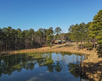
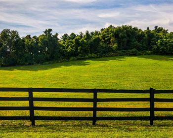
This beautiful lot is approximately 0.59 acre. It is located near the foot of the mountains and the Lincoln National Forest in Otero County, New Mexico.
Timberon is a sparsely developed subdivision. This property is Timberon, Unit 17 Block 187 Lot 42.
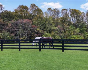
You will have phenomenal mountain views of the Sacramento Mountains and be less than half a mile away from a gigantic acreage of National Forest Service land. The beauties of nature virtually surround you in the Lincoln National Forest.
Lot 42 is mixed woods and open, and has a change in elevation of about 30 feet. It has frontage along Trisha Circle, its address is 24 Trisha Circle.
Camping is allowed and RV's and travel trailers can be used as a temporary residence for up to 30 days each year while you hold the property for investment. Electricity is available but municipal water is not available, so for now it is recreational and not for a full time residence. Rough it as much as you like, but you really should try nearby Connie's Deli Restaurant and the High Country Lounge & Grill.
The National Forest Service can advise you on their tremendous hiking trails, ATV trails, small game hunting, and big game hunting such as elk, mule deer, and turkey. You can have the greatest wildlife watching and nature photography experiences of your life.
This is a beautiful, unspoiled, and secluded area. A great place for your dreams to come true.
Everyone qualifies for the same financing, we do not run credit checks.
With an initial payment of $294 ($99 down payment + $195 document fee) we will finance the balance for as little as $87.89 per month over six years. Or you can choose to buy this property outright instead of financing, and receive a 10% cash discount.
For more information or to purchase, please click on the green Land Website button below.
Land Maps & Attachments
Directions to Land
From Albuquerque NM.
Drive south on Interstate 25 for appoximately 85 miles.
Take Exit 139 for US-380 E toward San Antonio / Carrizozo.
0.5 mile later continue onto US-380 E.
64.8 miles later turn right onto East Avenue.
0.6 mile later turn right onto US-54 W / Central Avenue.
53.9 miles later turn left onto US-82 E.
16.2 miles later turn right onto NM-130.
1.8 miles later turn right onto Sunspot Highway.
15.2 miles later continue straight onto Sacramento Canyon Road.
12.7 miles later continue onto FS 537 / Sacramento River Road
1 mile later turn left onto Bobwhite Street.
500 feet later turn right onto Merlin Drive.
0.2 mile later turn left onto Swift Drive.
407 feet later turn left onto Shelley Drive.
1 mile later continue onto Johnnys Drive.
1 mile later turn right.
0.1 mile later turn right.
220 feet later you will be at the property.
More Land Details
More Land from Samantha Stephens
 0.3 AC : $4K
- 1.2 AC : $9K
- 0.2 AC : $7K
- 0.3 AC : $3K
- 5 AC : $10K
- 7.5 AC : $12K
- 1 AC : $4K
- 5 AC : $30K
- 10 AC : $20K
- 0.8 AC : $9K
- 7.5 AC : $12K
- 1.8 AC : $7K